
The rest of the climb wasn’t too bad. I was more concerned about going down the other side. However, my Garmin sent me off on a quiet road. There were three cars standing on one side and I asked them if this was ok and they replied that it was surfaced all the way to Ettendorf and from there I could get to Lavamund, which was further than on the main road. However it meant less traffic and because of the greater distance it wasn’t so steep, so I followed it. It descended and descended and I thought it was never going to end. It finally did and there was a cycle route to Lavamund alongside the river Lavant. After that there was s cycle path along the road before branching off to a small village. It was long since time for my coffee break and I had been looking out for a Gasthaus. I saw two tables outside what looked like a normal house, but there was a small sign saying it was a Gasthaus. The lady brought me coffee in a China cup and a large beer-glass of water for two euros. There was also a toilet, which of course I made use of. Then the adventure began. My sat-nav sent me uphill on a very rough track. I manage to cycle up over stones and routes until shortly before the top, but the path down was very narrow. I followed it, as no way did I want to turn round and go back the way I had come, but it got narrower and narrower and was extremely rough. In addition to the roots and stones there were lots of pinecones. It was like a dried up brook and extremely difficult to walk and push the bike, and I breathed a sigh of relief when we finally made it. Then it was very varied mostly on quiet roads and a long stretch along a gravel road. My Garmin told me to turn off onto an agricultural road. This started as a widish track, that obviously hadn’t been used for years. At one point I was told to turn right, but I didn’t see a road or even a path to turn to. Sat-nav protested so I returned and could just make out a path, which I followed on foot and pushing my bike. Again it got even narrower between high reeds and again I breathed a sigh of relief when it was over. After that it was fairly uneventful and I felt my first few drops of rain before I arrived at Kloppeinersee at 2:30. I was able to check in, as this wad from 2 p.m. onwards.


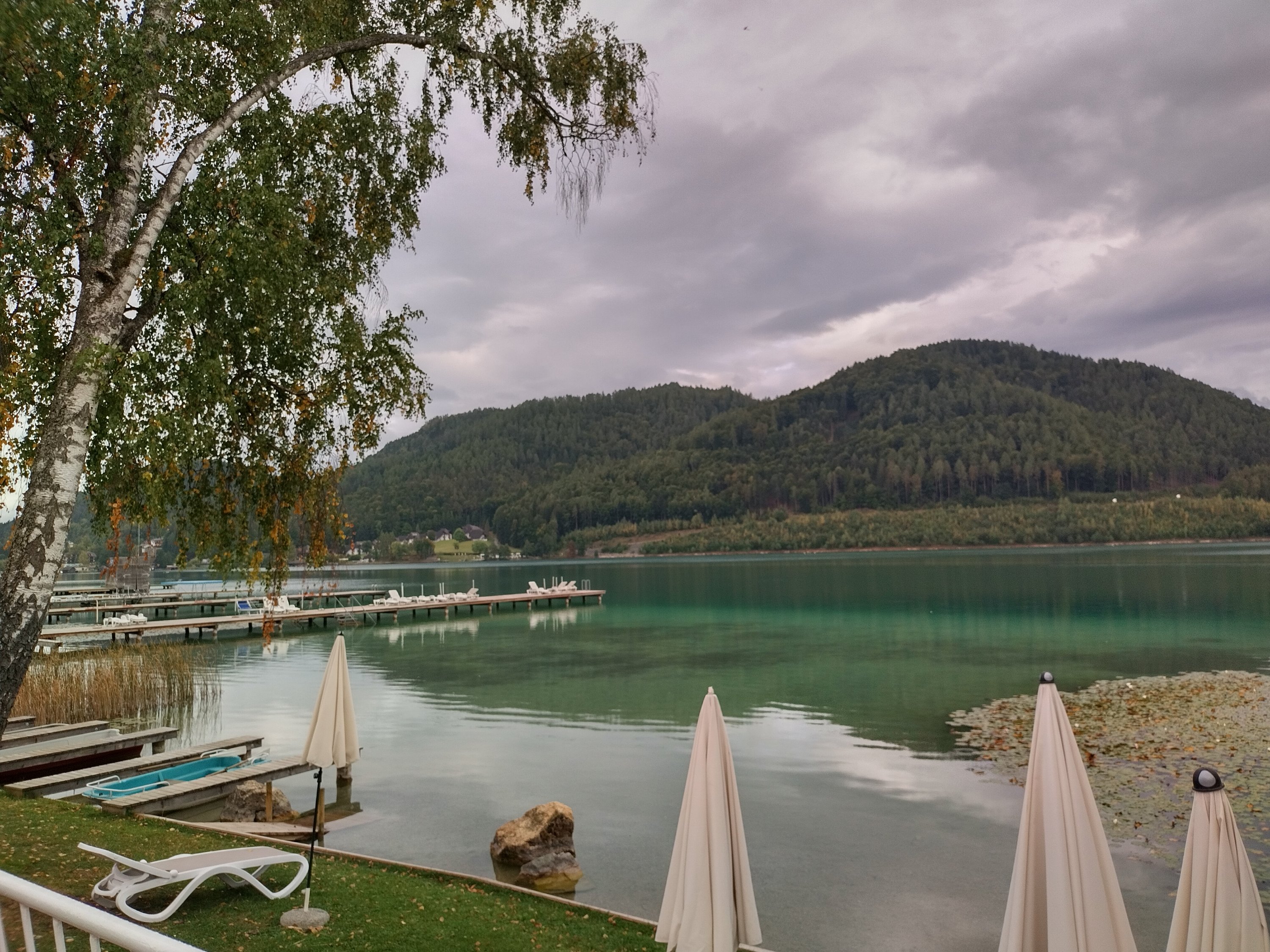
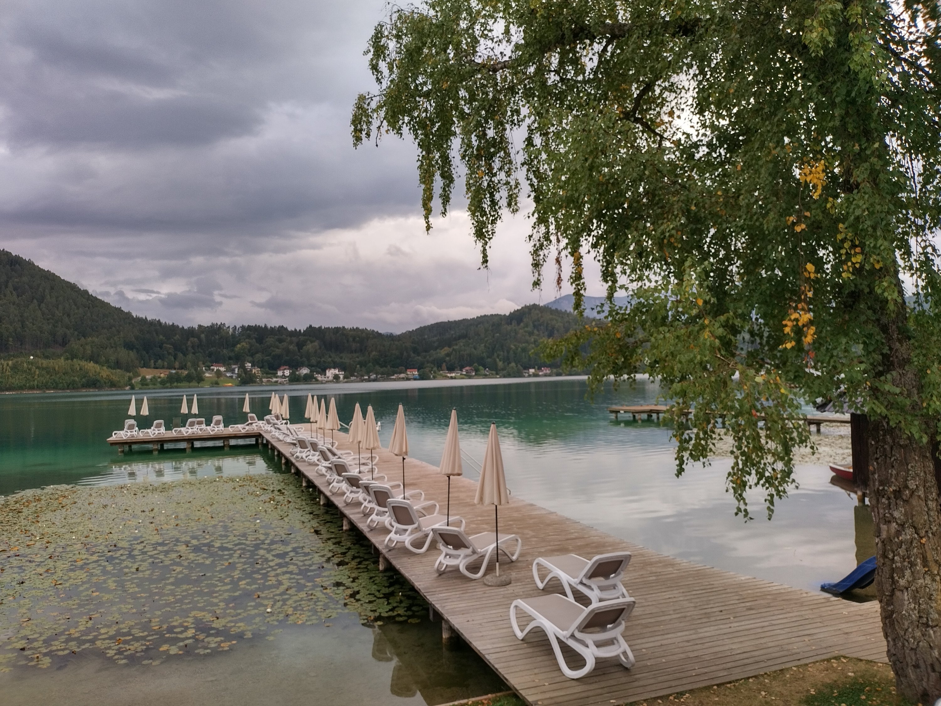
Der Rest des Aufstiegs war nicht so schlimm. Ich war mehr besorgt übers Herunterfahren auf der anderen Seite. Mein Garmin schickte mich jedoch von der Hauptstraße weg. Auf einer Seite standen drei Autos und ich fragte sie, ob diese ruhige Straße in Ordnung sei und sie antworteten, dass sie bis Ettendorf asphaltiert sei und ich von dort nach Lavamund kommen würde, eine Strecke, die weiter als auf der Hauptstraße war. Allerdings bedeutete es weniger Verkehr und wegen der größeren Entfernung war es nicht so steil, also folgte ich ihm. Es ging hin und her und ich dachte, es würde nie enden. Endlich war es soweit und es gab einen Radweg entlang der Lavant nach Lavamund. Danach gab es einen Radweg entlang der Straße, bevor er zu einem kleinen Dorf abzweigte. Es war längst Zeit für meine Kaffeepause und ich hatte nach einem Gasthaus Ausschau gehalten. Ich sah zwei Tische vor, was wie ein normales Haus aussah, aber es gab ein kleines Schild, das besagte, dass es sich um ein Gasthaus handelte. Eine Dame brachte mir Kaffee in einer Porzellan Tasse und ein großes Bierglas Wasser für zwei Euro. Es gab auch eine Toilette, die ich natürlich genutzt habe. Dann begann das Abenteuer. Mein Navi schickte mich auf einer sehr holprigen Strecke bergauf. Ich schaffe es, über Steine und Wege bis kurz vor dem Gipfel hochzuradeln, aber der Weg nach unten war sehr schmal. Ich folgte ihm, da ich auf keinen Fall umkehren und den Weg zurück nehmen wollte, den ich gekommen war, aber er wurde schmaler und schmaler und war extrem holprig. Neben den Wurzeln und Steinen gab es viele Tannenzapfen. Es war wie ein ausgetrockneter Bach und extrem schwer zu gehen und das Fahrrad zu schieben, und ich atmete erleichtert auf, als wir es endlich geschafft hatten. Danach ging es sehr abwechslungsreich meist auf ruhigen Straßen und einer langen Strecke entlang einer Schotterstraße. Mein Garmin sagte mir, ich solle auf eine landwirtschaftliche Straße abbiegen. Dies begann als ein breiter Weg der offensichtlich seit Jahren nicht mehr von landwirtschaftlichen Fahrzzeugen benutzt wurde. Irgendwann teilte mir mein Garmin mit, ich solle rechts abbiegen, aber ich sah weder eine Straße noch einen Weg, auf den ich abbiegen könnte. Das Navi protestierte, also kehrte ich zurück und konnte gerade noch einen Weg erkennen, dem ich zu Fuß folgte und mein Fahrrad schob. Wieder wurde es zwischen hohen Schilfrohren noch enger und wieder atmete ich erleichtert auf, als es vorbei war. Danach war es ziemlich ereignislos und ich spürte meine ersten Regentropfen, bevor ich um 14:30 am Kloppeinersee ankam. Ich konnte einchecken, da dies bereits ab 14 Uhr möglich war.

